2009-07-19
22:35
Several
people
store
geographical points within CouchDB and would like to make a
bounding box
query on them. This isn’t possible with plain CouchDB
_views. But there’s
light at the end of the tunnel. One solution will be
GeoCouch
(which can do a lot more than simple bounding box queries), once there’s a new
release, the other one is already there: you can use a the
list/show
API (Warning: the current wiki page (as at 2009-07-19) applies to CouchDB 0.9, I use the new 0.10 API).
You can either add a _list function as described in the
documentation or use my
futon-list
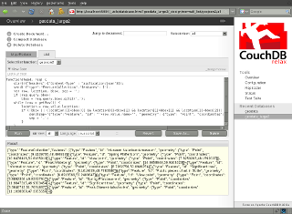
branch which includes an interface for easier _list function creation/editing.
Your data
The _list function needs to match your data, thus I expect documents with
a field named location which contains an array with the
coordinates. Here’s a simple example document:
{
   "_id": "00001aef7b72e90b991975ef2a7e1fa7",
   "_rev": "1-4063357886",
   "name": "Augsburg",
   "location": [
       10.898333,
       48.371667
   ],
   "some extra data": "Zirbelnuss"
}
The _list function
We aim at creating a _list function that returns the same response as a
normal _view would return, but filtered with a bounding box. Let’s start
with a _list function which returns the same results as plain _view (no
bounding box filtering, yet). The whitespaces of the output differ slightly.
function(head, req) {
    var row, sep = '\n';

    // Send the same Content-Type as CouchDB would
    if (req.headers.Accept.indexOf('application/json')!=-1)
      start({"headers":{"Content-Type" : "application/json"}});
    else
      start({"headers":{"Content-Type" : "text/plain"}});

    send('{"total_rows":' + head.total_rows +
         ',"offset":'+head.offset+',"rows":[');
    while (row = getRow()) {
        send(sep + toJSON(row));
        sep = ',\n';
    }
    return "\n]}";
};
The _list API allows to you add any arbitrary query string to the URL. In
our case that will be bbox=west,south,east,north (adapted from the
OpenSearch
Geo Extension). Parsing the bounding box is really easy. The query
parameters of the request are stored in the property req.query as
key/value pairs. Get the bounding box, split it into separate values and
compare it with the values of every row.
var row, location, bbox = req.query.bbox.split(',');
while (row = getRow()) {
    location = row.value.location;
    if (location[0]>bbox[0] && location[0]<bbox[2] &&
            location[1]>bbox[1] && location[1]<bbox[3]) {
        send(sep + toJSON(row));
        sep = ',\n';
    }
}
And finally we make sure that no error message is thrown when the
bbox query parameter is omitted. Here’s the final result:
function(head, req) {
    var row, bbox, location, sep = '\n';

    // Send the same Content-Type as CouchDB would
    if (req.headers.Accept.indexOf('application/json')!=-1)
      start({"headers":{"Content-Type" : "application/json"}});
    else
      start({"headers":{"Content-Type" : "text/plain"}});

    if (req.query.bbox)
        bbox = req.query.bbox.split(',');

    send('{"total_rows":' + head.total_rows +
         ',"offset":'+head.offset+',"rows":[');
    while (row = getRow()) {
        location = row.value.location;
        if (!bbox || (location[0]>bbox[0] && location[0]<bbox[2] &&
                      location[1]>bbox[1] && location[1]<bbox[3])) {
            send(sep + toJSON(row));
            sep = ',\n';
        }
    }
    return "\n]}";
};
An example how to access your _list function would be:
http://localhost:5984/geodata/_design/designdoc/_list/bbox/viewname?bbox=10,0,120,90&limit=10000
Now you should be able to filter any of your point clouds with a bounding
box. The performance should be alright for a reasonable number of points. A
usual use-case would something like displaying a few points on a map, where you
don’t want to see zillions of them anyway.
Stay tuned for a follow-up posting about displaying points with
OpenLayers.
Categories:
en,
CouchDB,
JavaScript,
geo

